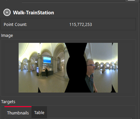
The BLK2GO Walk (Walk is the name of a unique BLK2GO capture event with images and GeoTags) will appear in the SiteMap area as a single Setup with the number of WayPoints determined by the user-defined trajectory settings in the Import area.

-
Each WayPoint contains a panoramic image to support traditional visualization options. The WayPoint locations are listed in the right panel under WayPoints.
-
Fly into selected WayPoint from the right-side menu by right-clicking WayPoints and selecting Jump to WayPoint:

-
Scroll through all WayPoints using the up and down arrow keys on the keyboard. The image will change in the right-side panel showing different WayPoint images:
Each WayPoint has the following abilities:
-
Fly into the point cloud to view panoramic image and point cloud.
-
Selection in the SiteMap to Pan and Rotate scan.
-
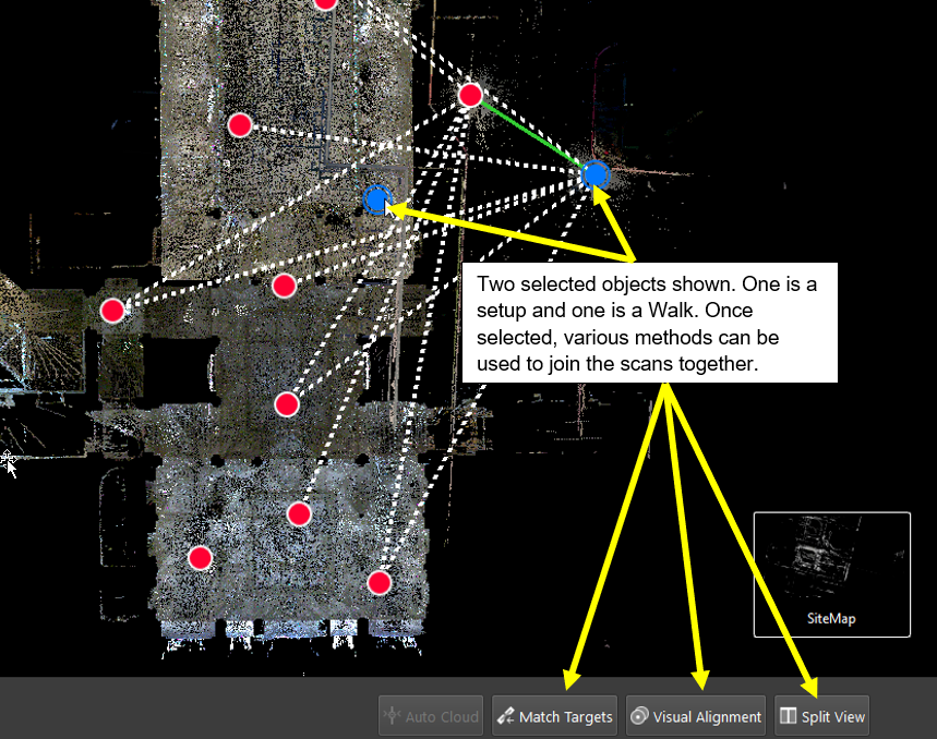
Selection in the SiteMap area with another scan to perform registration by:
-
Visual Alignment
-
Target matching (with inserted targets)
-
Registration supported to another BLK2GO Walk or Setup (i.e., RTC360, BLK360, BLK360 G1, P-Series, C-Series)
-
Publish to Jetstream, LGS, and TV as Panoramic image Setup locations.
Visual Registration with BLK2GO data is performed in the same manner as for any other data imported into Cyclone REGISTER 360 PLUS.
-
In the SiteMap area, select a single Setup or WayPoint and then Multi-Select another Setup or WayPoint.
-
Fence selection will also work to select the desired Setups and Walks.
-
Moving the Setup and or Walk-in proximity to another will make suggested links appear.
-
Select a suggested link to enter the desired registration type.
-
Click the Visual Alignment button on the action bar to enter Visual Alignment.