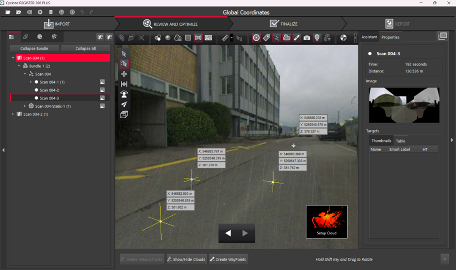
Scans collected with BLK ARC during autonomous outdoor missions with the GA03 GNSS antenna (BLK ARC-UI) can be now georeferenced using the positioning information collected and stored in the B2G file.
With this feature, it is possible to have the global coordinates available for each point of the processed point cloud.
Workflow Overview
To import BLK ARC scans containing georeferenced data into Cyclone REGISTER 360 PLUS, follow the steps below:
-
Download the job from BLK ARC using the Data Manager.
-
Drag and drop the data contained in the job folder into Cyclone REGISTER 360 PLUS.
-
(Optional) Use the map to visualize the scans on a satellite map:
-
Click Show Geo Image Bar to visualize the satellite view.
-
Locate your site and click Get Image.
-
Click Place by Geo Coordinates to automatically place the scan according to the global coordinates.
-
Double-click the SiteMap to centre the view.
-
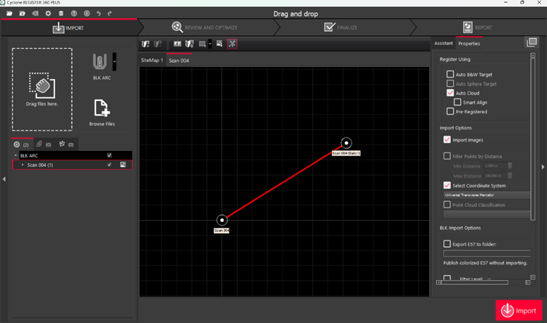
Select the Coordinate System in the Import Options and define other Import and Registration settings.
-
Select Auto Cloud in Import settings to automatically align multiple scans.
-
-
Import the data.
Alternative Workflow
If the global coordinates are not read upon the first import of the raw data into Cyclone REGISTER 360 PLUS, it is required to import scans twice using specific import settings mentioned in the workflow below:
-
Download the job from BLK ARC using the Data Manager.
-
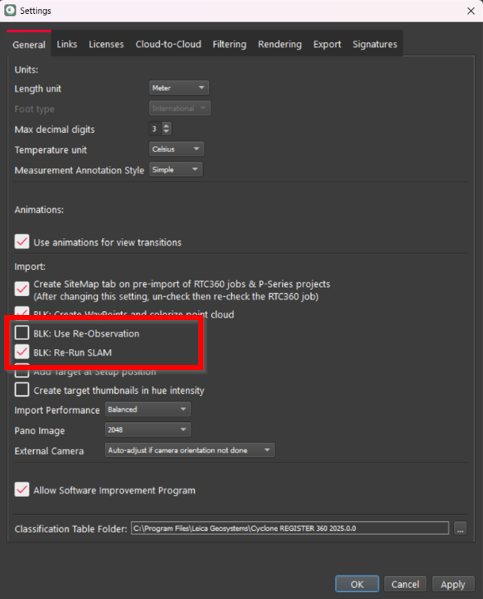
Navigate to Settings | General and define Import settings in Cyclone REGISTER 360 PLUS. Ensure SLAM recalculation upon the import is enabled by choosing one of the settings below:
-
BLK: Re-Run SLAM
-
BLK: Use Re-Observation
-
-
Drag and drop the job folder into Cyclone REGISTER 360 PLUS and import the data.
-
Remove the imported scan from the project or delete the project altogether.
-
Import the same B2G file again:
-
Drag and drop the B2G file into Cyclone REGISTER 360 PLUS.
-
-
(Optional) Use the map to visualize the scans on a satellite map.
-
Click Show Geo Image Bar to visualize the satellite view.
-
Locate precisely the environment and click Get Image.
-
Click Place by Geo Coordinates to automatically place the scan according to the global coordinates.
-
Double-click the SiteMap to centre the view.
-
-
Select the Coordinate System in the Import options and define other Import and Registration settings.
Note: SLAM recalculation is not mandatory this time to retrieve the GNSS data.
a. Select Auto Cloud in Import settings to automatically align multiple scans.
-
Import the data.