New features
Assets align to your coordinate system
Your scans now open in the coordinate system you set during registration, instead of raw scanner orientation. The viewer grid, view cube, SiteMap, and any new limit boxes line up with your User Coordinate System (UCS) axes — so everyone opening the asset sees it the same way, without taking a measurement first to check the orientation is right.
Exports match the viewer — when you export a point cloud (LAS, PTS, or E57), the exported coordinates use the same coordinate system shown in the viewer, so your data lines up wherever you take it next.
Note: UCS support inside scenes and on referenced assets isn't included yet.
More measurement unit options: survey and imperial feet
You can now work in the units your project already uses. Pick your unit system once, and every measurement, coordinate, GeoTag, limit box, level, and deviation readout shows up that way — no converting before you can use a number. Five display modes are available:
Metric (m)
Imperial International (ft) — decimal feet
Imperial International (ft + in) — feet with fractional inches
Imperial Survey (ft) — decimal feet, US survey foot
Imperial Survey (ft + in) — feet with fractional inches, US survey foot
Set your default in My profile under User details — it applies to every new dataset you open. You can also override it for a single asset in Display settings, on the Units tab. And when you share an asset with General access, you can choose the measurement system it opens in for whoever receives the link. See Units of measurement for the full list of modes and how each is displayed.
Existing imperial users are moved to Imperial International (ft), so no workflow changes silently.
Improvements
Redesigned visualization settings
The visualization settings panel has a new layout that's easier to read and interact with, and handles longer labels and other languages more gracefully.
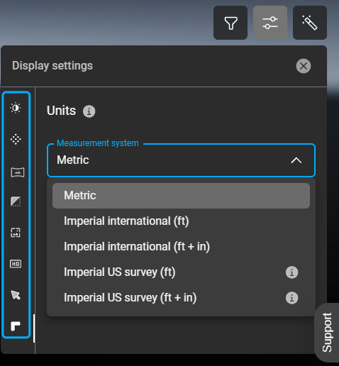
Display settings
Bug fixes
Measurements in panoramic view for older datasets — On some datasets uploaded a few months ago, switching to panoramic view and starting a measurement left the measurement panel stuck on "Loading measurable data…" and it never finished. Measurements in panoramic view now work as expected.
Correct measurement values in panoramic view — When measuring in panoramic view, distances could come back much larger than the real value. Panoramic-view measurements now match point-cloud measurements.