New features
Sharper BLK360 panoramas with Image enhance
Your BLK360 G2 panoramas can now be enhanced for better colour, brightness, and sharpness without leaving Hexagon GeoCloud, so the imagery you and your stakeholders review matches the quality you expect from the scanner. When an uploaded asset qualifies, an Image enhance option runs the enhancement for you.
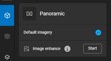
Image enhancement
Image enhance processing consumes your subscription quota.
Open a qualifying asset and start Image enhance from the asset explorer. Once the pipeline finishes, the panoramas are marked as Enhanced imagery, the enhanced version is what you see in the viewer, and the improved imagery carries through to meshing.
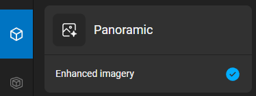
Image enhancement done
To set it up and check the full requirements, see Image enhancement in the documentation.
When Image enhance is available
Your capture needs to meet all of the following:
Every setup captured on a BLK360 G2 (mixed-device datasets aren't supported yet)
BLK360 G2 on firmware 2.0 (March 2025) or newer
Data processed in Register 360 (or Register 360 BLK Edition) 2026.0.0 (February 2026) or newer
Uploaded to GeoCloud as an LGSx, with HDR panoramas included at full quality
Image enhance is opt-in and applied per asset.
It's one-way for now — to go back to the original images, re-upload the asset.
While it's running, other processing on that asset waits until it finishes.
Measure and place GeoTags on panoramas, no point cloud needed (LGSx)
You can now take measurements and place GeoTags directly on the panoramic images in an LGSx file, without waiting for the point cloud to load. In Panorama mode, GeoCloud uses the depth information included in the LGSx, so you can measure and geotag right away — a real time-saver on large datasets, slower connections, or older hardware. If the asset also has a point cloud, GeoCloud keeps using it in Point Cloud mode; only Panorama mode uses the depth map.
Applies to LGSx files that include panoramic depth data.
This isn't available inside Scenes yet.
When an asset has only panoramas and no point cloud, the magnifier isn't available.
Improvements
Project "Last modified" reflects work on its contents - A project's "Last modified" — both the time and the user — now updates whenever its contents change. That covers adding, removing, moving, copying, or updating an asset, as well as creating, renaming, or deleting a folder. Previously it only tracked edits to the project itself, so the timestamp now reflects the latest activity in the project.
Changes to items within an asset, such as adding a GeoTag, don't update the timestamp yet.
Artifacts panel always available - The Artifacts panel is now accessible for every asset, including assets that contain only a panorama, so you can always reach an asset's artifacts.
Bug fixes
Correct asset name when dragging in an OBJ with other files - Previously, dragging several files into GeoCloud together that included an OBJ could name the asset after another file, such as an IFC. The asset now takes its name from the OBJ.
Members can edit their own profile - Previously, users with the Member company-account role couldn't save changes to their own user details. They can now update their own profile.
GeoTags now copy across assets as expected - Previously, copying GeoTags onto an asset you have editor rights on could fail with a permission error, even when you were allowed to copy them. GeoTags now copy to the target asset as expected.