autocad basic autocad pro revit navisworks bricscad basic bricscad pro ultimate
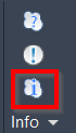
Info | Point Cloud Info
Command Line
-
AutoCAD / BricsCAD: CWINFO
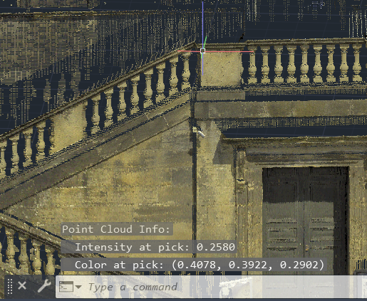
This command displays coordinate information and other information for a selected point in a point cloud.
All the coordinates and distance parameters are based on the current user coordinate system and unit preference.
The user can use CAD's measurement and dimension tools to measure between cloud points.
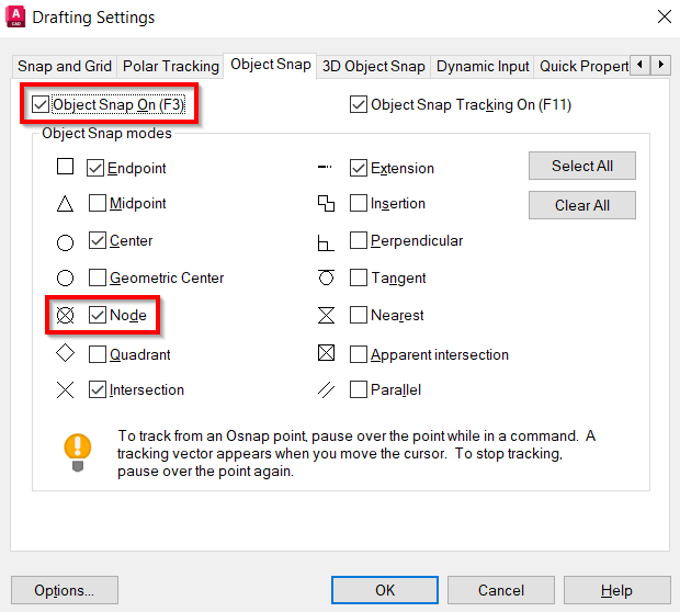
Note: When Snap to Cloud Points is enabled, Object Snap On is turned on, and Node type is selected (OSNAP), all commands, including CAD commands that require 3D point clicking, will perform picking on point clouds. When a cloud point is picked, the 3D position will be returned as the result of the 3D point. However, the result may not be compatible with some 2D commands, such as POLYLINE.
Using the Tool
To get point information:
-
Ensure the Object Snap is enabled and the Node type is selected, using the OSNAP command:
-
Click Point Cloud Info in the Info panel or type a command line prompt specific to the preferred CAD system and press ENTER.
-
When prompted, pick a point in a point cloud. The point coordinates, as well as other possible information, such as intensity and colour value (where applicable), are displayed.