Autocad Pro Revit ultimate
A GeoTag is a defined location in Cartesian coordinate space that has asset(s) associated with it. GeoTags created in Cyclone REGISTER 360 PLUS or Cyclone FIELD 360 can be viewed downstream in TruView, TruView LIVE, and CloudWorx.
GeoTags can be useful for identifying objects of interest in a registration. Assets, such as websites, pictures, and other file types, can be attached to provide more information about the object.
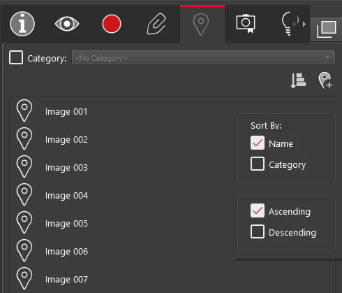
The GeoTags panel lists all GeoTags that were published with the project, whether as an LGS/LGSx file, a JetStream Enterprise or Cyclone ENTERPRISE project.
GeoTag Categories
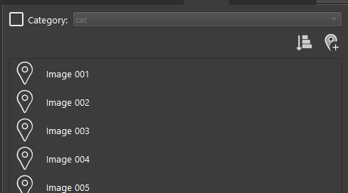
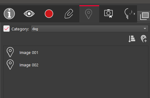
GeoTags can also be categorized. Within TruSpace, GeoTags can be filtered by their category for quick identification.
To enable the category filter, select the Category check box. If available, the drop-down list of categories will appear. Selecting a category will only display the GeoTags associated with that category.
Sort GeoTags
To sort GeoTags, click the Sort GeoTags button ![]()