November 2, 2022
What’s New
This is a major release including support for Mobile Mapping projects and support for classification amongst other new features and improvements.
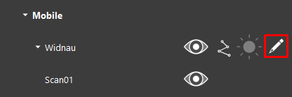
Common Viewer- Support for Mobile Mapping Projects
With the 2022.1 release of TruView, both the desktop and browser versions will begin to include support for Mobile Mapping (MMS) data and other features from the Pegasus Viewer and the Cyclone 3DR Free Viewer.
This change signals a first stage of consolidation of those disparate viewers to better support reality capture users use of multiple data sources.
TruView remains a free program intended to provide user’s and their clients with a simple tool for viewing and sharing reality capture data.
Support for Mobile Mapping projects
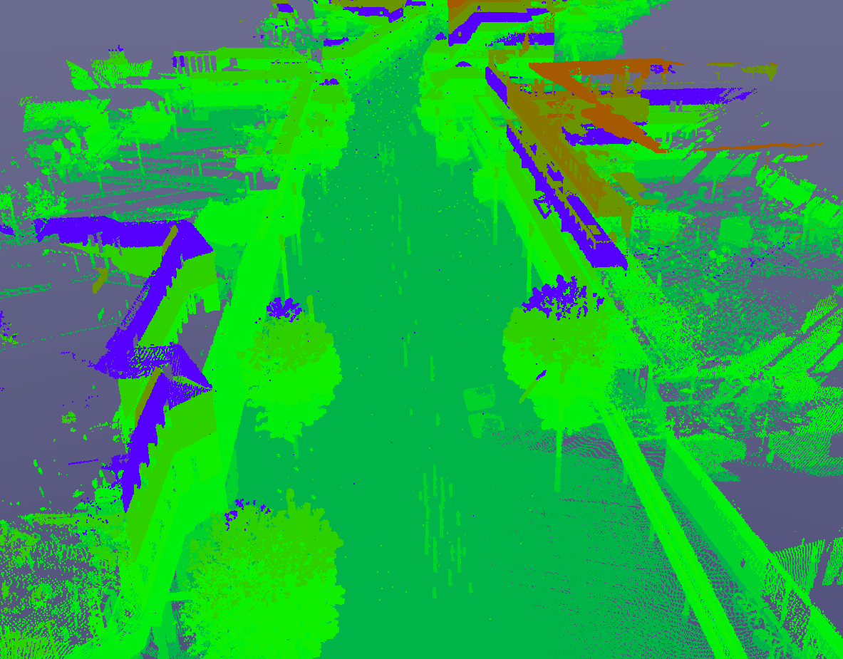
In addition to MMS point clouds, which were previously supported in TruView when published to Cyclone ENTERPRISE or LGS file, TruView now supports both pano images and tracks coming from MMS projects.
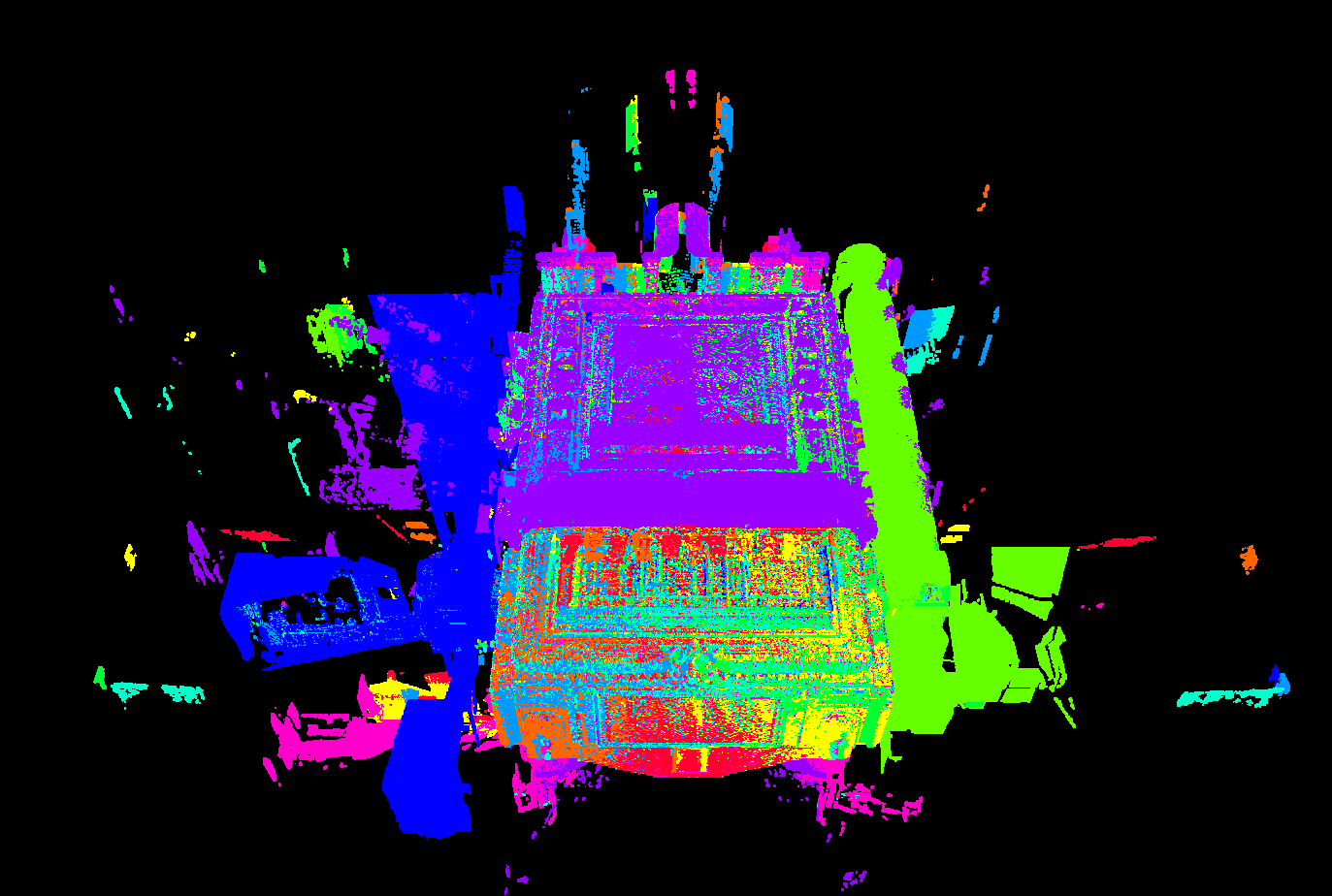
Tracks
The track is displayed in the SiteMap overview and MiniMap as well as the 3D data allowing users to intuitively navigate through MMS data. Users can fly along the track by selecting the Fly Track navigation option; this tool operates much the same as the current Flythrough mode but anchored to the track to prevent straying from the trajectory.
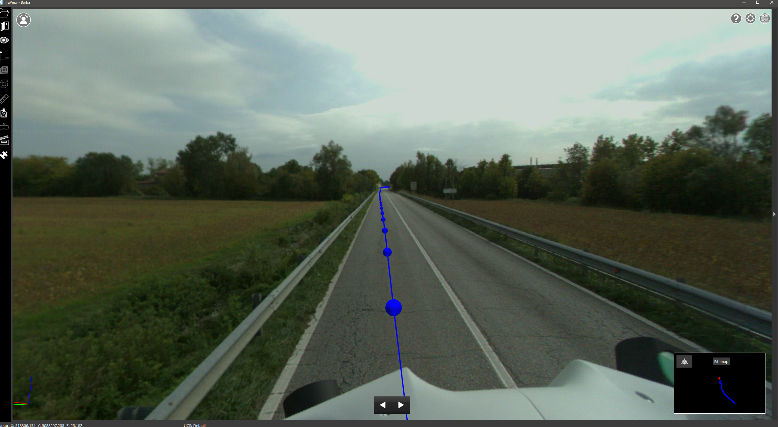
Users can use the keyboard arrows or the buttons in the floating toolbar to move forward and backward and the scroll wheel to zoom in on Pano images. Click and drag the left mouse button to pan around the pano at any point.
By displaying and tethering to the track, users will have a better understanding of the capture quality of their mobile data in the same way that Setup placement can inform users of the quality of a TLS project.
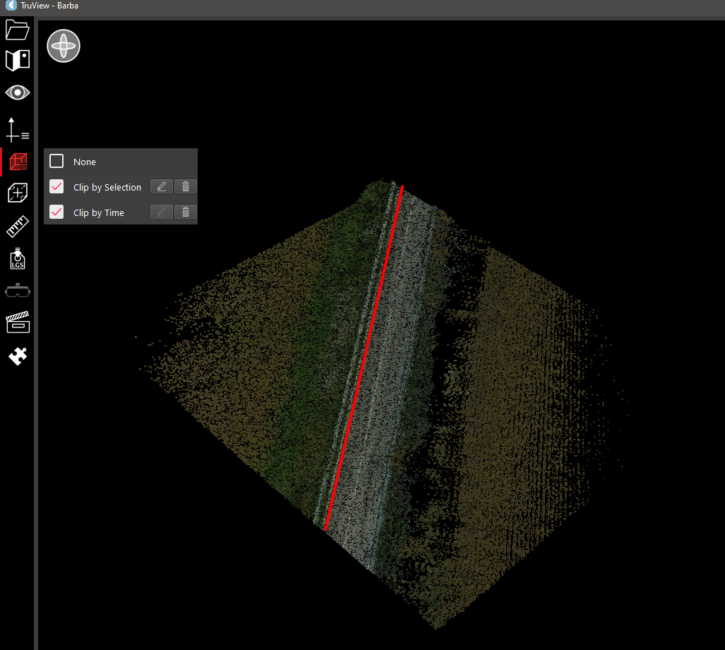
Clip Track by Time
in addition to the standard geometric clipping options in TruView, users will have the option of clipping MMS data by time allowing them to sub-select a portion of track based on when it was captured. The tool can be used by defining a time in seconds, then clicking anywhere along the trajectory. The point cloud will be clipped at +/- the defined time from the point at which the user clicks along the trajectory.
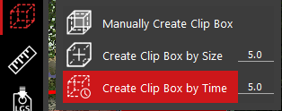
Clip by Time and geometric clip boxes can be used simultaneously.
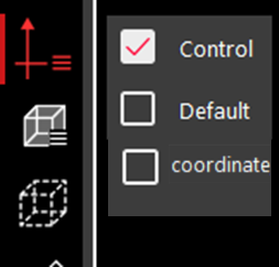
Color by Track/Setup
In addition to the standard rendering options (Greyscale, Hue intensity, RGB), users can also render the data by track and assign specific colors to the track to more easily identify the source of data when interspersed with other tracks. Users will also be able to render by Setup when using TLS data
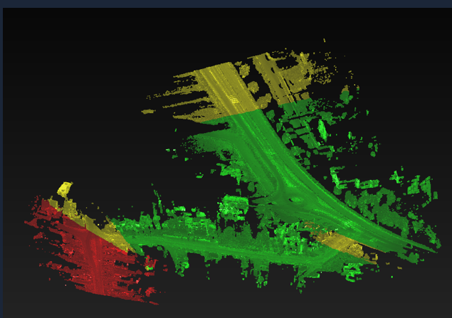
Users cannot change the classification of points but they can change the color assigned to a track/class to customize the render.
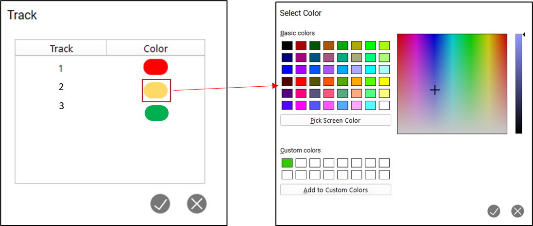
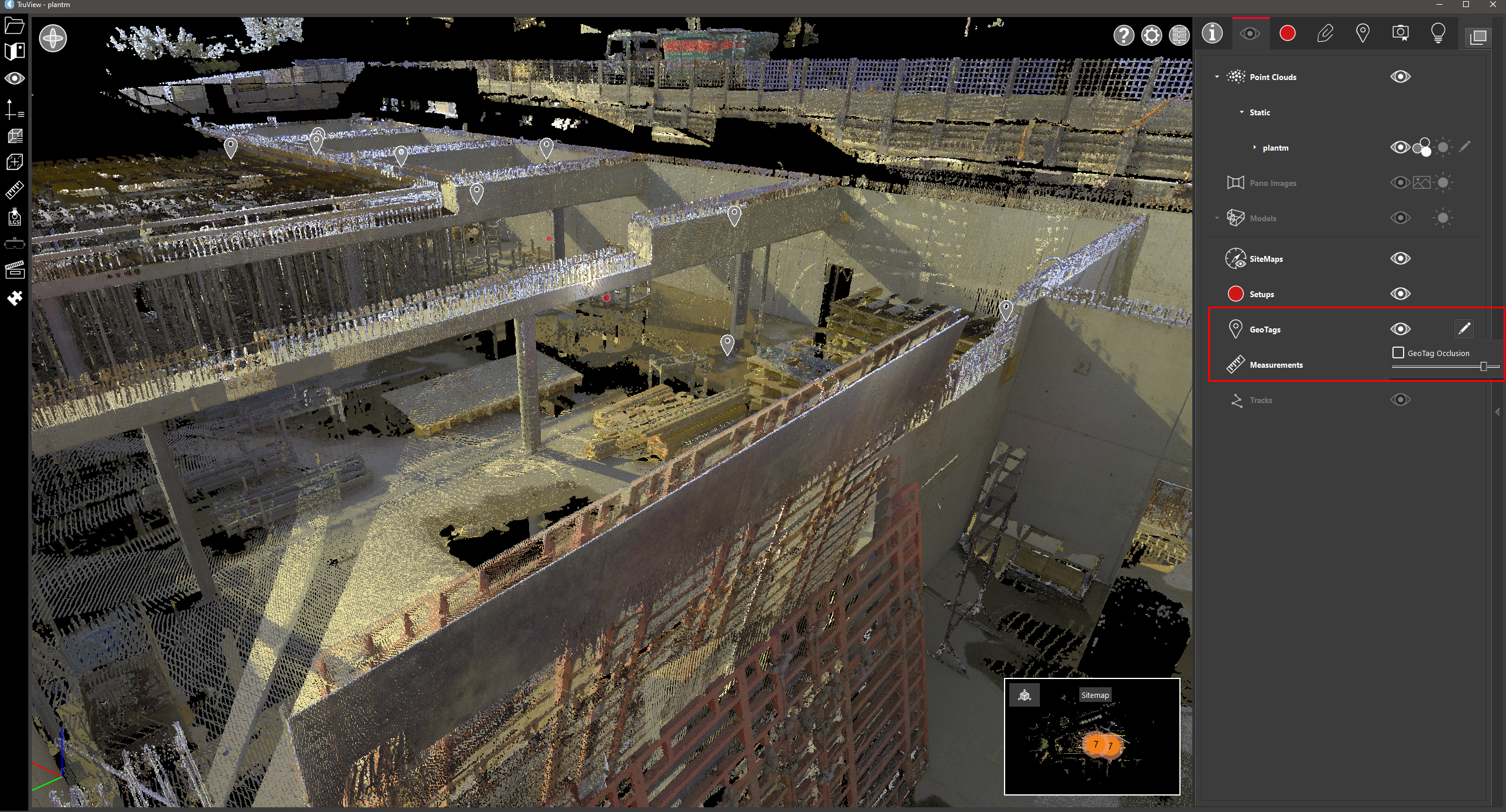
Point Cloud Visibility
Within the visibility panel, users will now see separate visibility options for terrestrial and mobile data. Mobile data includes Pegasus, BLK2GO, BLK2FLY and BLKARC. Users can expand the mobile data section to turn on and off individual tracks. The trajectory lines are also separately controlled, allowing users to carefully craft the view of their data as they wish.
Additional Metadata
The number of tracks in a project will now be represented in the project info panel in the same way that the number of Setups is represented.
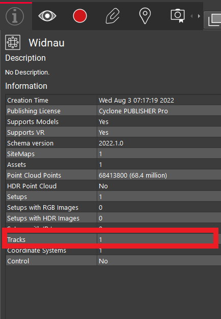
Within the Setups/Tracks panel, users can now navigate to specific Setups or tracks.
Online Help
With the 2022.1 release, TruView will now include an online help document matching that previously introduced in Cyclone REGISTER 360. For users who are working offline, TruView will fallback to an offline version.
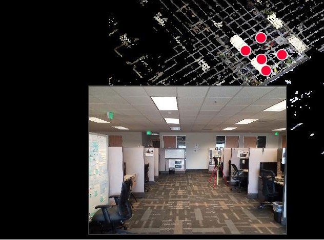
Improved GeoTag Handling
Users now have more control over the visibility of GeoTags in a scene. In addition to a toggle to turn then on/off, the distance at which they become occluded is now definable.
GeoTags will now be placed prior to filling out all GeoTag fields rather than after. This will allow users to see the point that was selected for the GeoTag within the scene to ensure that it is placed properly and that the tag information being added accurately represents the object being tagged.
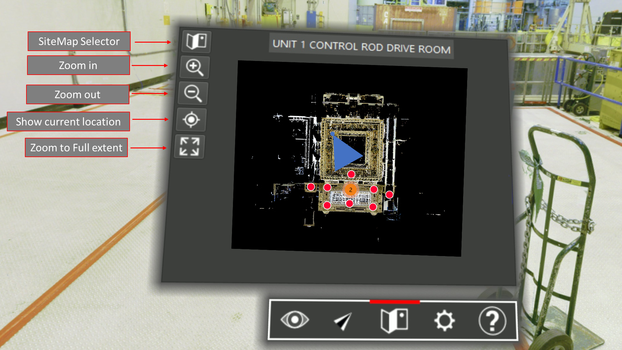
Improved VR features
Users will now have access to an interactive SiteMap inside of TruView VR. When multiple SiteMaps are present, they will be able to select between them. Users will also be able to zoom in and out on the SiteMap to see areas of interest more clearly.
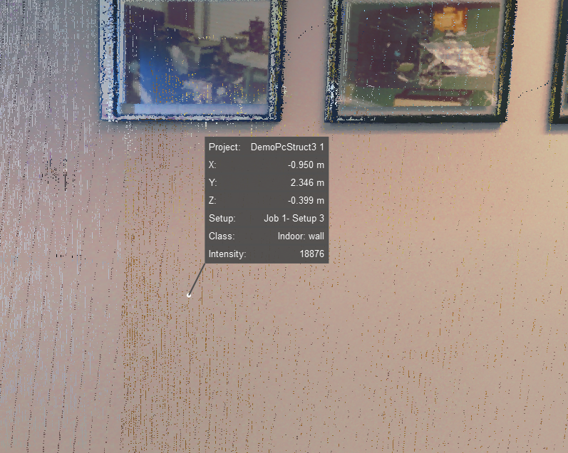
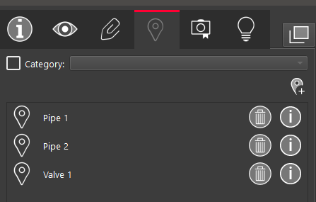
Point Info Tool
Users can now query the info of points and leave them as permanent markers separate from a Snapshot, the same as a measurement in a scene. Users will see what project the point is within, its X,Y and Z coordinates, what Setup/Track it is contained in, its intensity, and its class (if available).
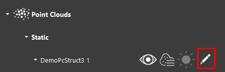
Classification
TruView now supports some limited classification actions.
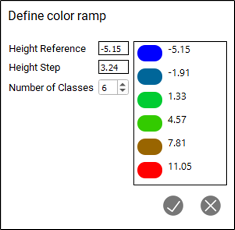
Color by Elevation
Users can select the render by elevation mode which will open the elevation rendering dialog.
The elevation classification does not need to be stored within the project already, it will be calculated within TruView.
Here, users can define the number of classes, the minimum height and the interval for each class. Users can also select the color for each class to customize the rendering further.
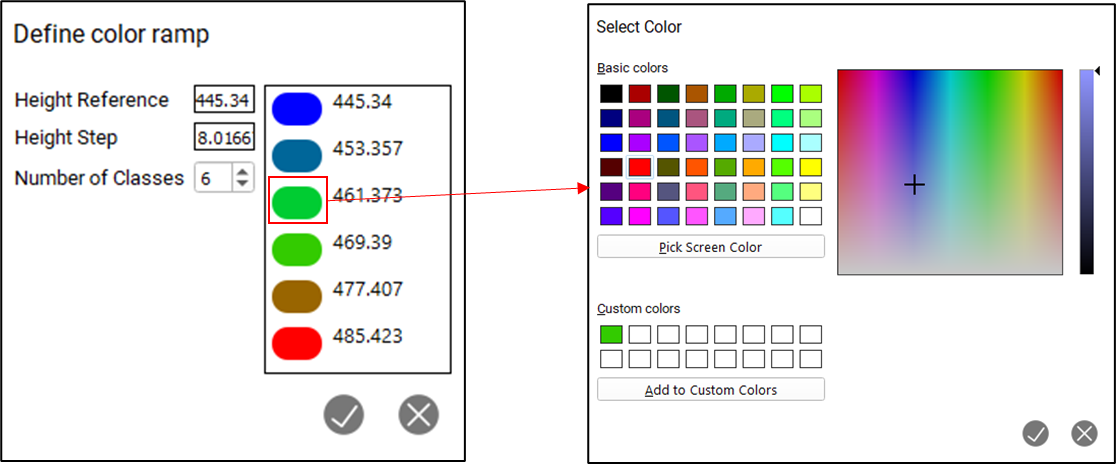
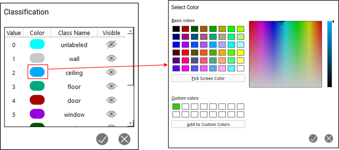
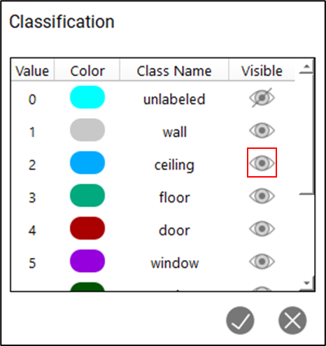
Color Point Cloud by Class
Users will now have the option of rendering points by classification. TruView will not perform the classification itself but will display classifications stored in LGS files that are published by products which do perform classifications.
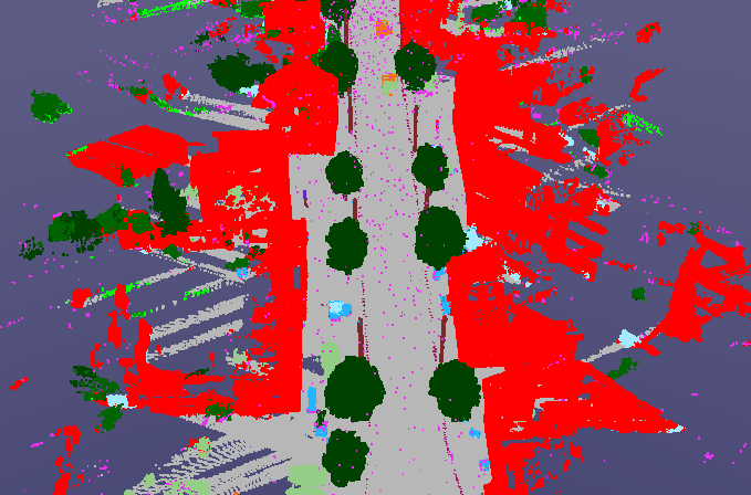
Users cannot change the classification of points but they can change the color assigned to a class to customize the render. They will also be able to turn on and off specific classes to eliminate unnecessary data from the scene without permanently deleting it or using clips to isolate it.
Active UCS on by default
As of Cyclone REGISTER 360 2022.1, users could define an Active UCS within a project, TruView will now display that Active UCS by default when it is present. All other project UCS' remain available for use.
This change will allow users to have greater control over how their project immediately display inside of TruView during their upstream publication process making this change particularly useful for users who use LGS files and TruView as a project deliverable or communication mechanism with their clients.
Delete Assets
Users can now delete assets to prevent projects from becoming bloated due to unnecessary files continuing to be attached. This will also ensure that outdated files do not remain attached and cause confusion.
Navigation improvements
Users can now control the speed of Fly-throughs using keyboard shortcuts. while in Fly through mode, use the up and down arrow keys to increase or decrease the speed of flight.
Users can now reposition their view inside of Ortho mode by clicking and dragging rather than zooming out and then in again on the new focal point.
Per Setup point cloud visibility
Users can now turn point clouds on and off at the Setup level rather than the project level allowing people to narrow the scope of their view without permanently removing data or having to re-publish without the extra Setups.

Bugs
-
Fixed a bug that prevented existing coordinate picks from respecting a change the the project UCS.
-
Improved import speeds and usability of COE models.
-
Fixed a bug that caused pano images to display at a lower resolution.
-
Fixed a bug that prevented IFC files exported from TruView from being reimported.
-
Fixed a bug that caused a rendering issue when placing GeoTags.
-
Fixed a bug that mislabeled text assets in GeoTags as control.
-
Improved the accuracy of measurement picking.
Leica JetStream Viewer Compatibility and Upgrades
Compatibility with TruView 2022.1 and JetStream Enterprise server
TruView 2022.0.1 requires JetStream Enterprise 1.6 and newer for connected mode to access all JetStream-compatible features. TruView 2022.1 is compatible JetStream Enterprise 1.3 and newer, however non-synchronous versions will result in a limited toolset.
Model Compatibility
TruView 2022.1 supports models in LGS files and Cyclone ENTERPRISE projects. LGS files and Cyclone ENTERPRISE projects must be published from Cyclone 2020.1 or later, Cyclone REGISTER 360 (including BLK Edition) 2020.1 or later or JetStream Enterprise 2020.1 or later (for LGS files only) and published with a Cyclone PUBLISHER Pro license (for JetStream Enterprise projects published out as an LGS for model support, this means the project must have been originally published with a Cyclone PUBLISHER Pro license).
VR Compatibility
TruView 2022.1 supports TruView VR for LGS files and Cyclone ENTERPRISE projects. LGS files and Cyclone ENTERPRISE projects must be published from Cyclone 2020.1 or later, Cyclone REGISTER 360 (including BLK Edition) 2020.1 or later or JetStream Enterprise 2020.1 or later (for LGS files only) and published with a Cyclone PUBLISHER Pro license (for JetStream Enterprise projects published out as an LGS for TruView VR, this means the project must have been originally published with a Cyclone PUBLISHER Pro license).
Disconnected Mode
TruView 2022.1 can be installed and used without connecting to a JetStream Enterprise or Cyclone ENTERPRISE server. The free, stand-alone Viewer can open/read JetStream Viewer (JSV) files as well as LGS files. LGS files are exported from the JetStream Enterprise admin utility, Cyclone ENTERPRISE or from the Cyclone REGISTER family.
The disconnected mode, when viewing JSV files, does not support access to saved User Coordinate Systems (UCS) nor saved limit boxes, slices, and clips. This project information is stored in and managed by JetStream Enterprise, Cyclone ENTERPRISE or available in an LGS file.
Portable Mode
TruView 2022.1 Portable is a free, no-install version of the Viewer that can be packaged on a thumb drive and run from any PC, no network or Wi-Fi access required. Leverage most of TruView’s capabilities (all the same capabilities as the Disconnected Mode) in a go-anywhere package that can be navigated by even the most inexperienced point cloud user. Perfect for sharing data with organizations with IT hurdles for new software or as a marketing tool for prospective customers. The free viewer can read LGS files written from Cyclone, the Cyclone REGISTER 360 family, JetStream Enterprise or Cyclone ENTERPRISE projects and JSV files created before March 2020.
TruView Portable does not support TruView VR.
Deprecated Features
Leica Geosystems strives to provide support for the widest array of operating systems and file formats possible as is reasonable given current technologies and support from third-party partners.
With each release, we review our list of currently supported formats and operating systems in line with industry trends and announced product terminations.
Leica Geosystems may add or terminate support for a file format during any release. Obsolete operating systems will be supported for six months after their announced termination or the next major software release, whichever comes first. Server products will be supported in alignment with Leica’s Client License Manager (CLM) supported servers to guard users against incompatibility.
TruView 2021:
-
Windows 7 is no longer supported.
TruView 2022:
-
TruView can no longer be installed in Windows 7, 8 or 8.1.
TruView 2022.0.1:
-
CLM versions prior to 2.5 ae no longer supported.
Known Issues
Model rotation rings clipped by clip boxes
When rotating a model, the rotation rings will obey an active clip thus being cut off when a temporary Clip Box or upstream Clip is active.
Model resizing
A previously scaled model may return to its original (as imported) scale upon being moved with the Align to Point function.
GeoTag preview does not close
When hovering over a GeoTag in the main viewing window the image preview does not close sometimes.
Workaround - Close and reopen TruView.
Changing the active server connection will cause a project opened in the current connection to stop working
If a project from one server is open and the active sever is switched to another server, the existing project will not work properly.
Workaround – If another server is set to the active server, close the current project.