Property Panel Options
The Properties panel provides detailed and useful information for the selected Tracks and WayPoints.
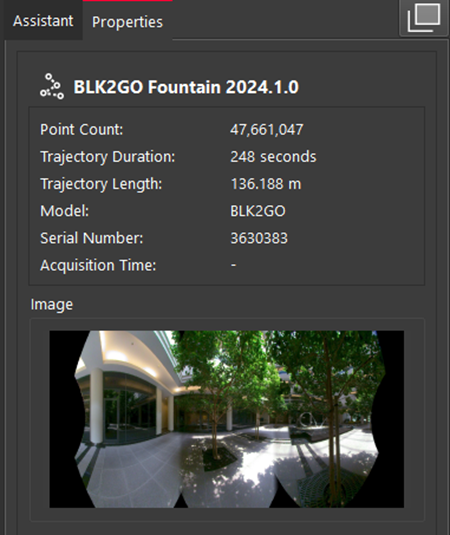
Selecting a Track displays details such as name, point count, trajectory duration, trajectory length, scanner type, serial number, and data acquisition date and time, if available. Additionally, the panel includes a panoramic image of the first WayPoint.
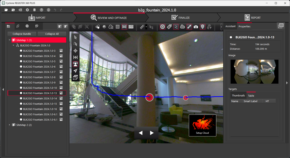
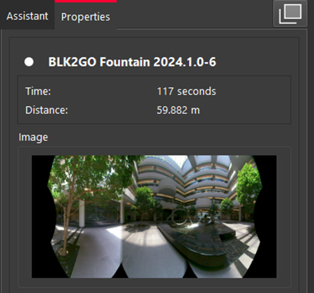
If a WayPoint is selected, the time and distance of the WayPoint from the start point and a panoramic image will be displayed.
Viewing Options
After selecting Tracks and WayPoints, they can be viewed in TruSlicer, Setup Cloud, or SiteMap views.
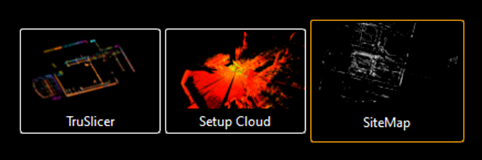
The behavior is the same as for a selected cloud. The main difference is that when choosing the Setup Cloud view for Tracks, the viewer navigates to the pano view of the first WayPoint. In contrast, when selecting a WayPoint, the viewer is taken directly to that specific WayPoint.
Context Menu Options
When right-clicking a Track, the following context menu options are available:
-
Show in Setup Cloud View: Navigates to the panoramic view of the first WayPoint, similar to the Setup Cloud viewing option.
-
Export Panoramic Image: Exports all WayPoint pano images to the local folder.
-
Delete Track: Deletes a Track and the associated WayPoints.
Note: To delete a Track, there should not be any Links to the WayPoints or a UCS set at a WayPoint.
-
Edit Track: Opens the Track Editor tool, allowing Track editing. This option is not available for non-editable Tracks.
-
Restore Deleted Points: Restores deleted points for visual, Cloud-to-Cloud, or both point cloud data.
When right-clicking a WayPoint, the following context menu options are available:
-
Show in Setup Cloud View: Navigates to the panoramic view of the selected WayPoint, similar to the Setup Cloud viewing option.
-
Show Suggested Links: Cyclone REGISTER 360 PLUS will search for and display potential links from the WayPoint to nearby Setups or WayPoints in different clouds.
-
Edit Image Blur: This tool allows users to edit panoramic images by manually adding blur or automatically blurring car plates and human faces.
-
Export Panoramic Image: Exports all WayPoint panoimages to the local folder.
-
Delete WayPoint: Deletes a WayPoint. It is also possible to delete WayPoint using the Track Editor tool.
-
Restore Deleted Points: Restores deleted points for visual, Cloud-to-Cloud, or both point cloud data.
Navigation
Navigation for Tracks and WayPoints are very similar. Upon choosing the Show in Setup Cloud Viewer context menu option, the user will be navigated to the selected WayPoint or the first WayPoint (in case of a Track). The Setup Cloud view of a WayPoint includes a panoramic view option, similar to a static Setup. This view is centered at the WayPoint location, allowing users to easily navigate and pan across the pano image. Project visibility controls and navigation tools and viewing orientation options are available.
The main difference for kinematic mobile data is the display of the trajectory line in the view. Moreover, navigation along this trajectory is possible using the Next and Previous WayPoint options. When transitioning between WayPoints, the forward viewing direction is preserved, meaning the view will face the direction of the BLK kinematic scan at the time of data capture at each WayPoint.