
2024.1 | CloudWorx Viewer


What’s New
CloudWorx Viewer Basics
CloudWorx Viewers extend the capabilities of the host application to support importing, rendering, and analyzing from small to very large Leica Geosystems reality capture data sets containing 3D point cloud, georeferenced imagery, setups, tracks, trajectories, waypoints and more.
You can now benefit from working with millions of accurate 3D points captured by reality capture sensors (3D laser scanning as well as Mobile Mapping Systems (MMS)) within the ArcGIS Pro software.
CloudWorx Viewer for ArcGIS Pro is a free, unlicensed viewer plugin.
Key Features
Following are the key features included in the first release CloudWorx Viewer for ArcGIS Pro users:
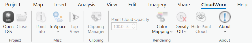
Dedicated CloudWorx Tab containing Leica’s essential 3D Reality Capture toolsets.
Open/Close LGS file (LGSx format only) onto Map and/or Scene views.
Render point cloud and tracks with pre-defined WKT* coordinate system.
Display detailed point info anywhere on point cloud.
Apply point cloud opacity level (100% to 0%).
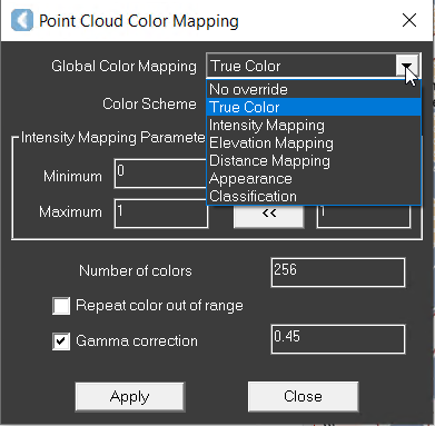
Select color mapping options including classifications (when available).
Apply point cloud density levels.
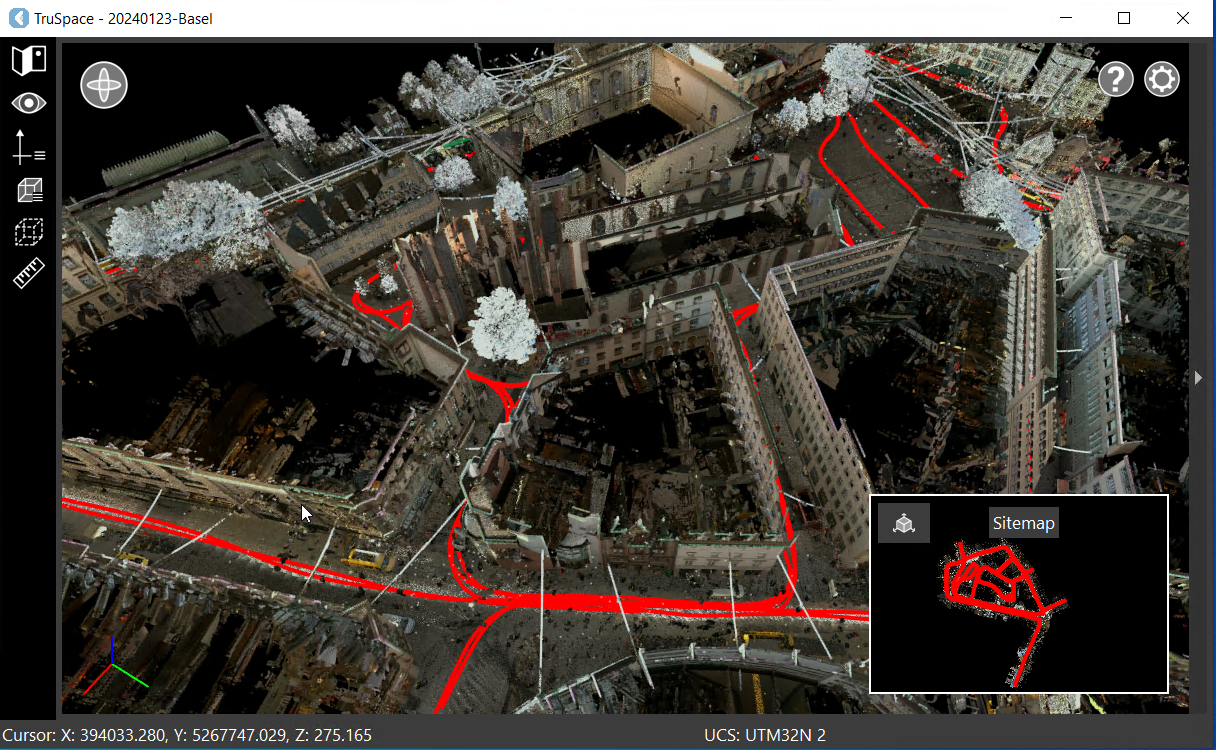
TruSpace Explorer - Enhanced 3D Reality Explorer with easy 3D navigation modes, clippings, measurements, GeoTag management, and visibility options.
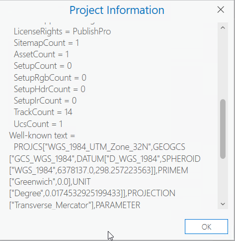
Display details on LGS project info (Under the About sub-menu).
Online help with easy-to-follow tutorials.
WKT - Well Known Text string representing the projected coordinate systems. The WKT string may be applied automatically upon user’s confirmation.
Online Help
CloudWorx Viewer for ArcGIS Pro is supported with online documentation. You may access the product help here:
CloudWorx Viewer for ArcGIS Pro | Help
Known Issues
ArcGIS Pro native navigation toolsets won’t operate over the Leica’s point cloud rendered region. It’s highly recommended to use the TruSpace Explorer for navigation or the ArcGIS Pro Navigator Controls.
Deprecated Features
Leica Geosystems strives to provide support for the widest array of operating systems and file formats possible as is reasonable given current technologies and support from third-party partners.
With each release, we review our list of currently supported formats and operating systems in line with industry trends and announce product terminations.
Leica Geosystems may add or terminate support for a file format during any release. Obsolete operating systems will be supported for six months after their announced termination or the next major software release, whichever comes first. Server products will be supported in alignment with Leica’s Client License Manager (CLM) supported servers to guard users against incompatibility.