June 26, 2025 | Reality Cloud Studio
What’s new
Auto-Align for comparison scenes
Auto-Align is now available for comparison scenes. After you are done with your manual alignment steps, you can press the “Auto-Align” button to fully align your reality capture scan with your BIM model to the highest accuracy possible.
Launching Auto-Align after a manual alignment has been completed
Custom text and list categories for GeoTags
GeoTags can now have custom text and list categories created at a project level.
Each list category value can have a custom color assigned to it for easier glanceability. Text categories allow for custom free-form text metadata to be added to the GeoTags in your projects. Both list and text categories allow for the metadata of your GeoTags to suit your business needs.
To create new categories simply access the “categories” tab in your project page. The new categories will be available to you when you create a new GeoTag in your assets.
Creating text and list categories on a project level
Using text and list categories in your assets
Panoramic setup position
We have added options in the 3D asset viewer on how to visualize panoramic setup positions. You now have the option of visualizing the setups using red disks at the height of the setup. You can also change the size of this visualization. This visualization more closely resembles other Leica Geosystems software:
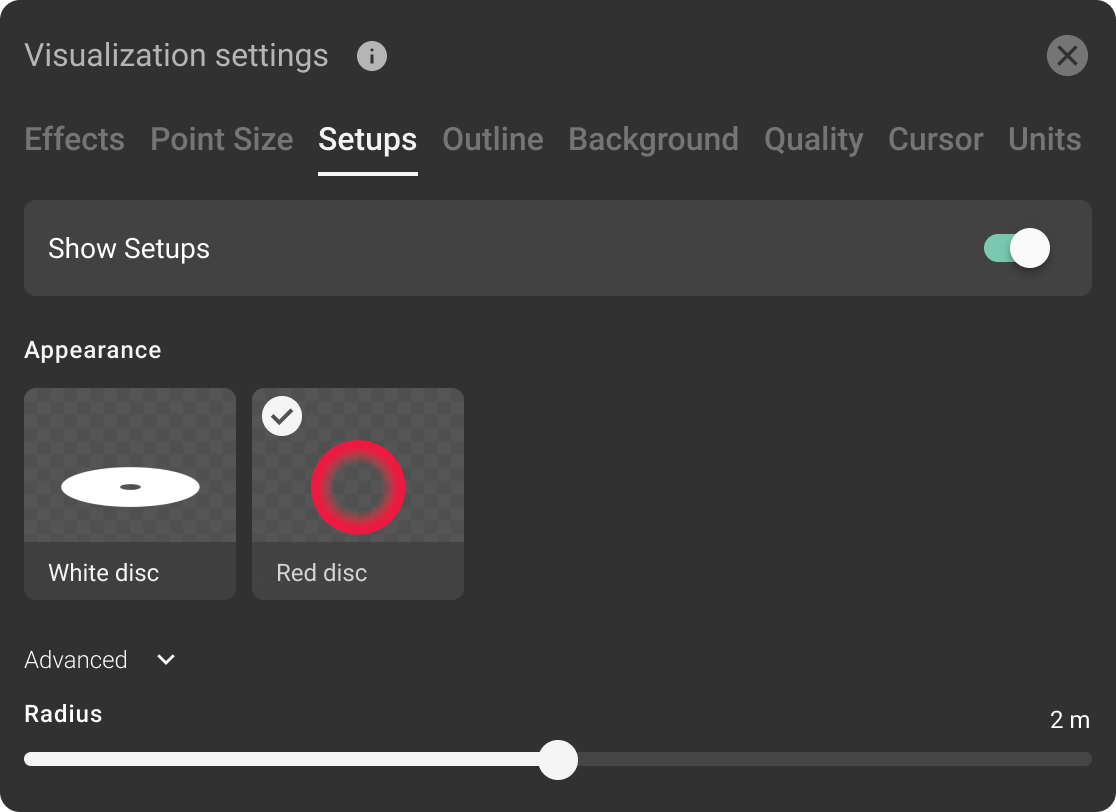
New visualization settings for Setups
Project data stored in your selected region
You can now choose to have a new project be created in a specific region. All data for the project will be stored in that region upon upload.
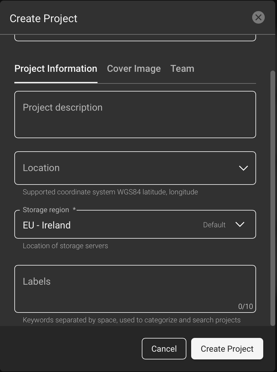
Selecting a “storage region”
Improvements
We have enabled global signup, allowing you to create an RCS company account from virtually any country.
We have updated the Hexagon logo to be aligned with the new design.
Bug fixes
Fixed auto-registration not being offered in case an asset did had a failed process (e.g. meshing).
Fixed missing translation issues to certain languages.
Known issues
Auto-registering b2g assets with a failed mesh is not offered to customers (auto-registration icon is wrongly grayed out).
Opening the Visualization Settings after changing the Quick Mode resets the Visualization Settings.
In the latest version of HxDR Data Flow 2.5.3 the link to Destination in the Upload Manager does not work. Unfortunately this also leads to the file size change to ZERO after one clicked the link.
In a very specific workflow starting with creating limitbox and then attemting to move to the mesh view (without a mesh being there) the asset view freezes
RCS is currently limited to 32 artifacts on a given asset, not loading any artifacts beyond that. After upload and meshing asset may have up to 20 artifacts. In case users trigger more than 12 exports (including limit box exports), the users will be affected by this issue. There are currently no known accounts that are affected by this limitation.
PRJ file is not respected for OBJ, GLB, IFC, Revit uploads resulting in non-georeferenced 3dtiles