Improvements
Simplified viewer menu
The legacy “Comparison Mode” toggle was removed from Visualization modes to reduce confusion and streamline the experience. At the moment the available visualization modes are: Point Cloud, Mesh, Panorama and Dollhouse.
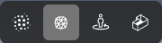
Visualization modes
Bug fixes
Shared links now show annotations correctly - measurements and GeoTags are visible when opening a shared asset.
GeoTags now respect Imperial/Metric settings - coordinates display in the unit system you selected.
Fixed a crash affecting NWD uploads - NWD files are less likely to fail during mesh generation.
Improved LAS georeference detection - LAS point clouds more reliably keep their correct coordinates/positioning.
GeoTags help links fixed - “Copy” and “Import” GeoTags dialogs now open the correct documentation page.
Licensed Content pagination layout fixed - page controls display correctly (centered as expected).
Error details for failed assets look clearer - improved styling and readability of error messages.
More consistent coordinate display - X/Y/Z indicators are aligned between Measurements and GeoTags.