Import BLK2GO PULSE data to Cyclone REGISTER 360
Wi-Fi import workflow
Connect to the wireless network of the BLK2GO PULSE scanner. SSID and PW are listed in the battery compartment of the scanner.
Once connected, open Cyclone REGISTER 360 PLUS or Cyclone REGISTER 360 PLUS (BLK Edition) and create a Project.
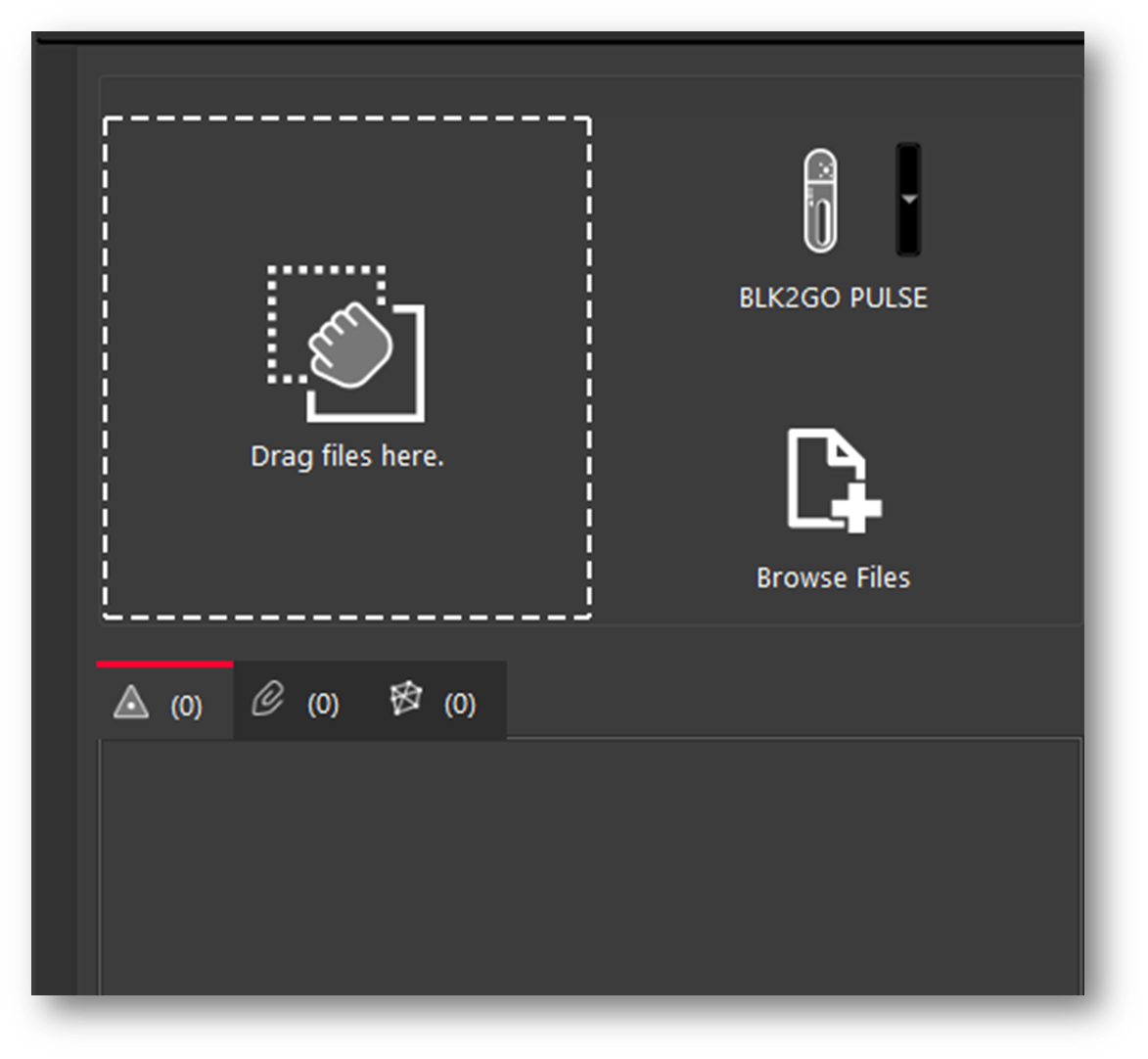
Click on the BLK2GO PULSE button to open the connection dialog:
The available scanners will be listed by serial number.
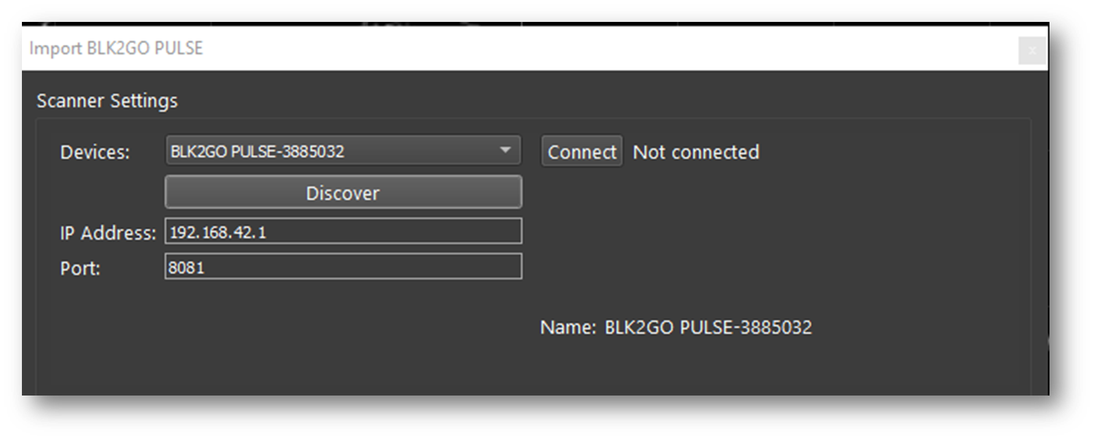
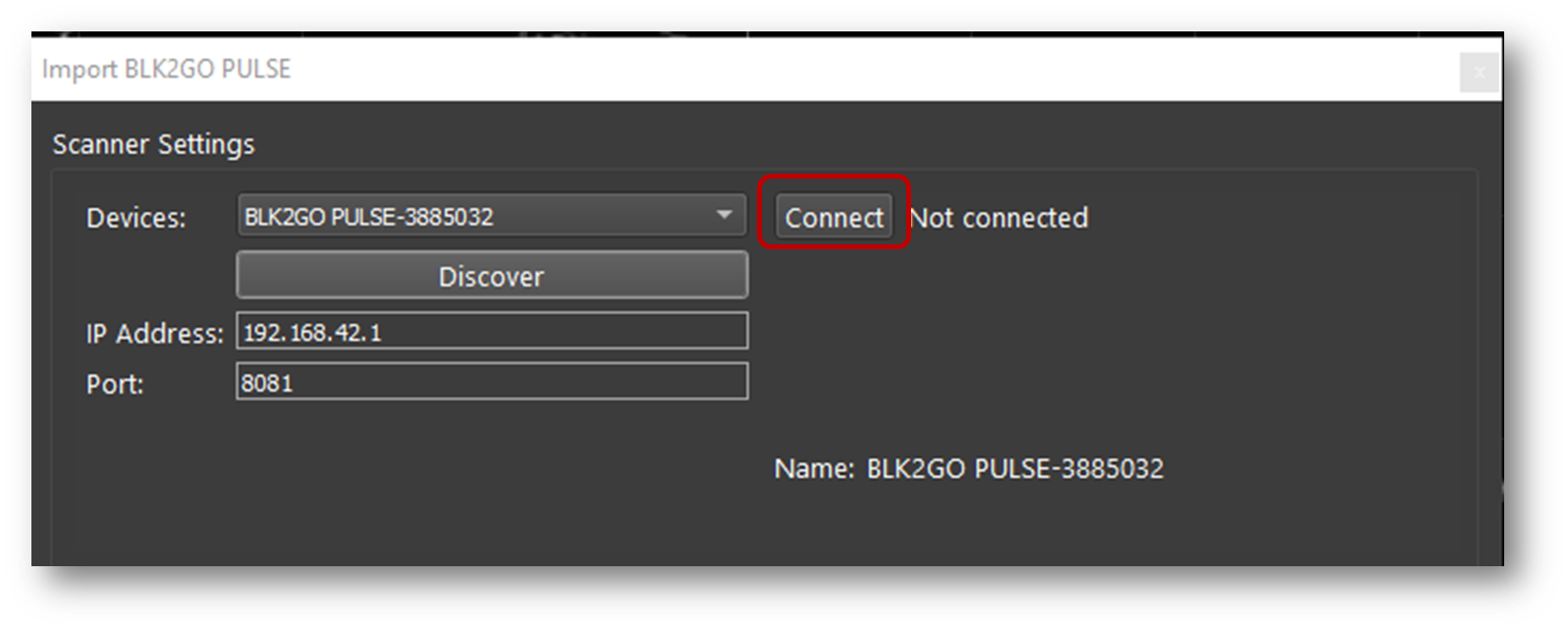
Click the Connect button to establish a connection to the scanner.
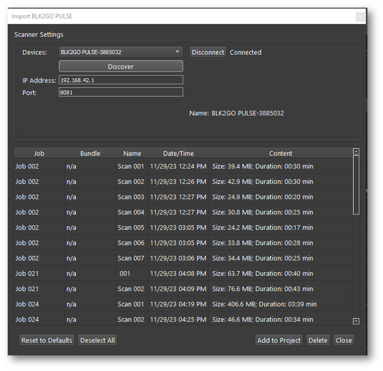
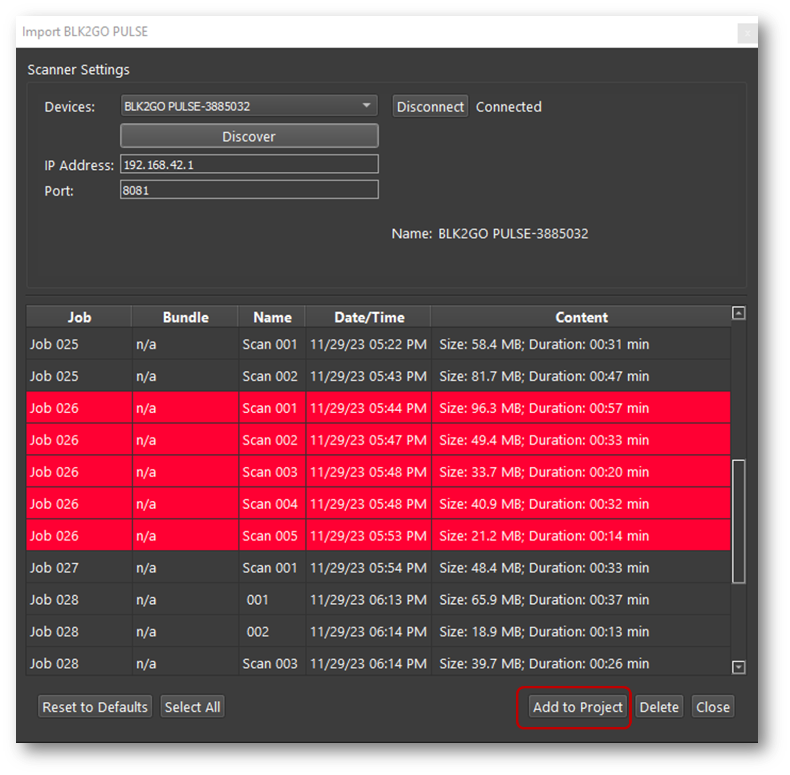
Then click the Add to Project button. This will add all available Jobs to the import panel.
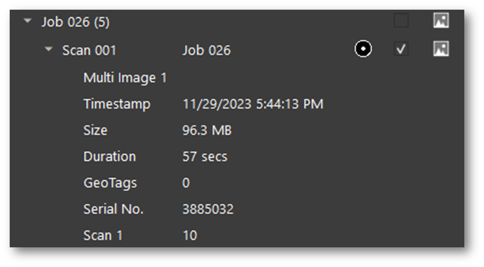
Listed under each Job are the size of the scan, duration, and the number of GeoTags.
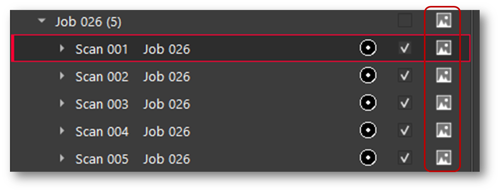
Select the walks to import by using the checkboxes to the right of each Walk.
Then, on the lower right side of the import area select the interval for WayPoint creation The default is one WayPoint every 10 m or 30 feet.
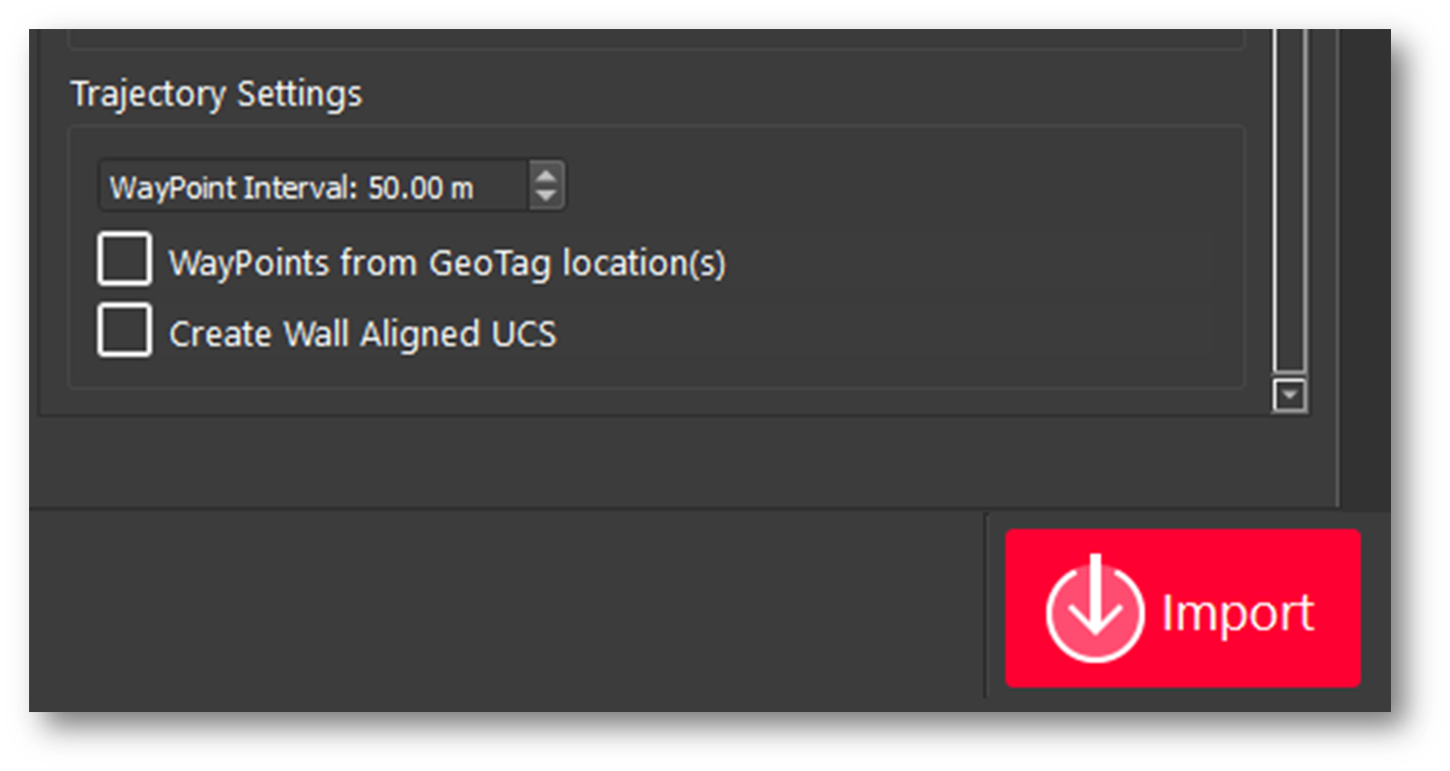
Enter an interval for Waypoint creation by distance along the trajectory of the Walk.
WayPoints are inserted setup positions that only contain pano image data.
The shorter the interval, the more WayPoints will be created.
Each WayPoint will take approximately 30-40 seconds to import.
Note: Increasing the number of WayPoints will result in longer import times.
Click the Save copy to local folder check box and then select a download location using the browse button to save a local copy of the scanner data to disk. The file extension is *.b2g.
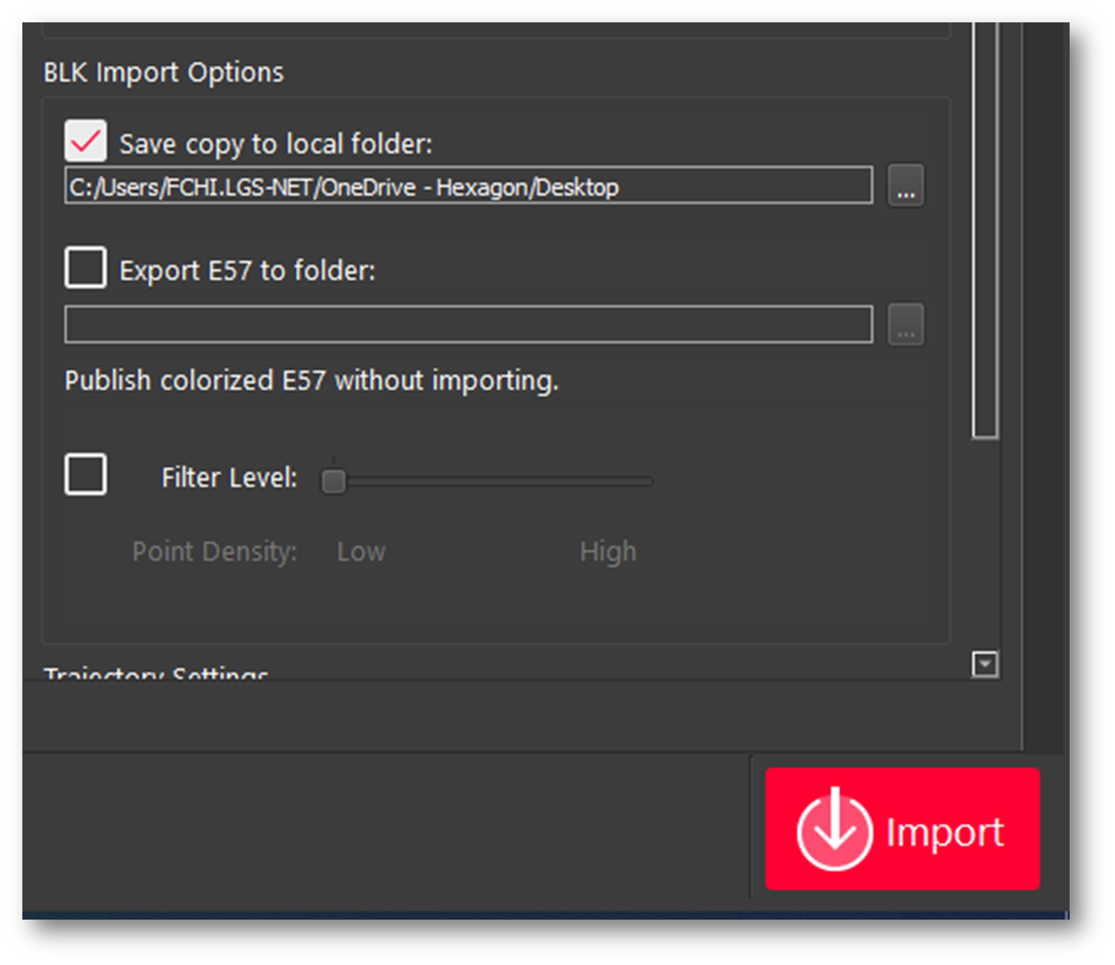
Note: This step is not necessary but recommended as best practice. Please always store a backup of your raw data.
Click Import to begin the import process.
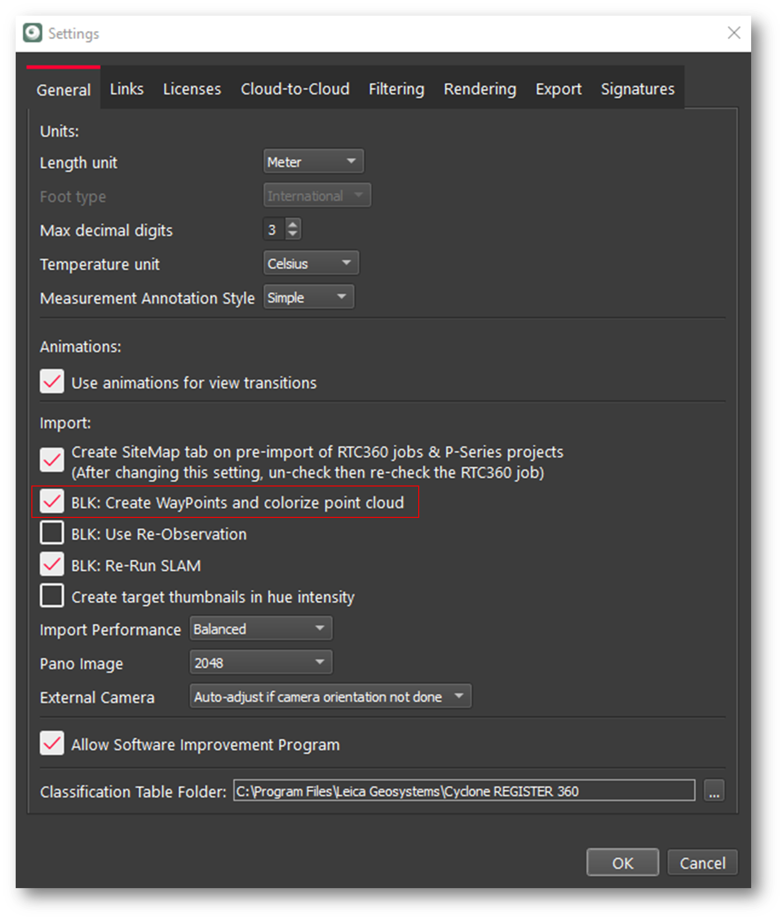
Quick import of data into REGISTER 360 without images and point cloud colors
To import the data into Cyclone REGISTER 360 PLUS without panoramic images and without colorizing the point cloud, in the Settings menu uncheck, the option “BLK2GO: create WayPoints and colorize point cloud”.
Note: Using this option will save import time as the point data is not colorized and the creation of Panoramic images is skipped.