
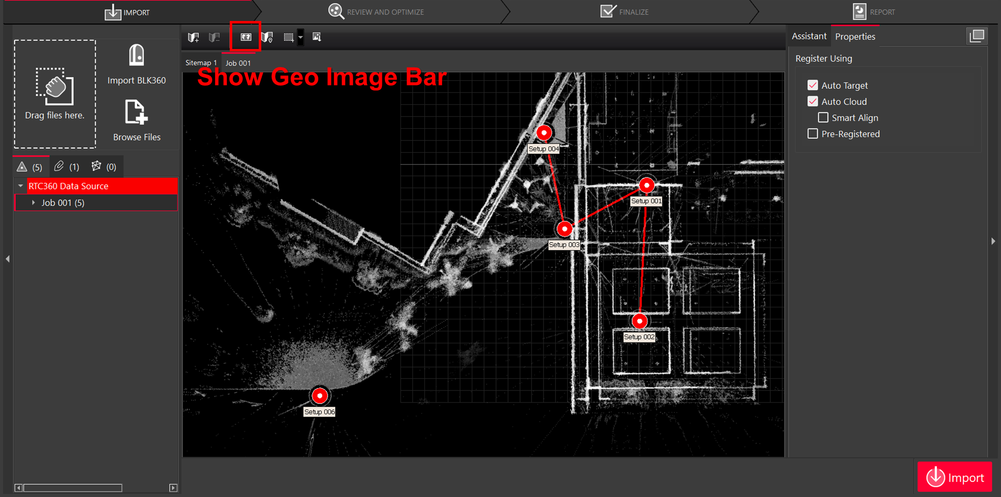
Geolocation of RTC360 Setups
Users may choose to activate GPS information for all data captured with RTC360. The location of globally positioned Setups can be read by Cyclone REGISTER 360 PLUS and automatically displayed on the built-in satellite or street map imagery used for SiteMap creation.
Click Show Geo Image in the action bar.
If the Setups have GPS location information, the satellite imagery will automatically zoom to the Project area for easy SiteMap creation and placement of additional scans.
Cyclone REGISTER 360 PLUS will attempt the best fit of the satellite image based on available data. The user may adjust the zoom level and area extent manually before selecting a view to use as a SiteMap.
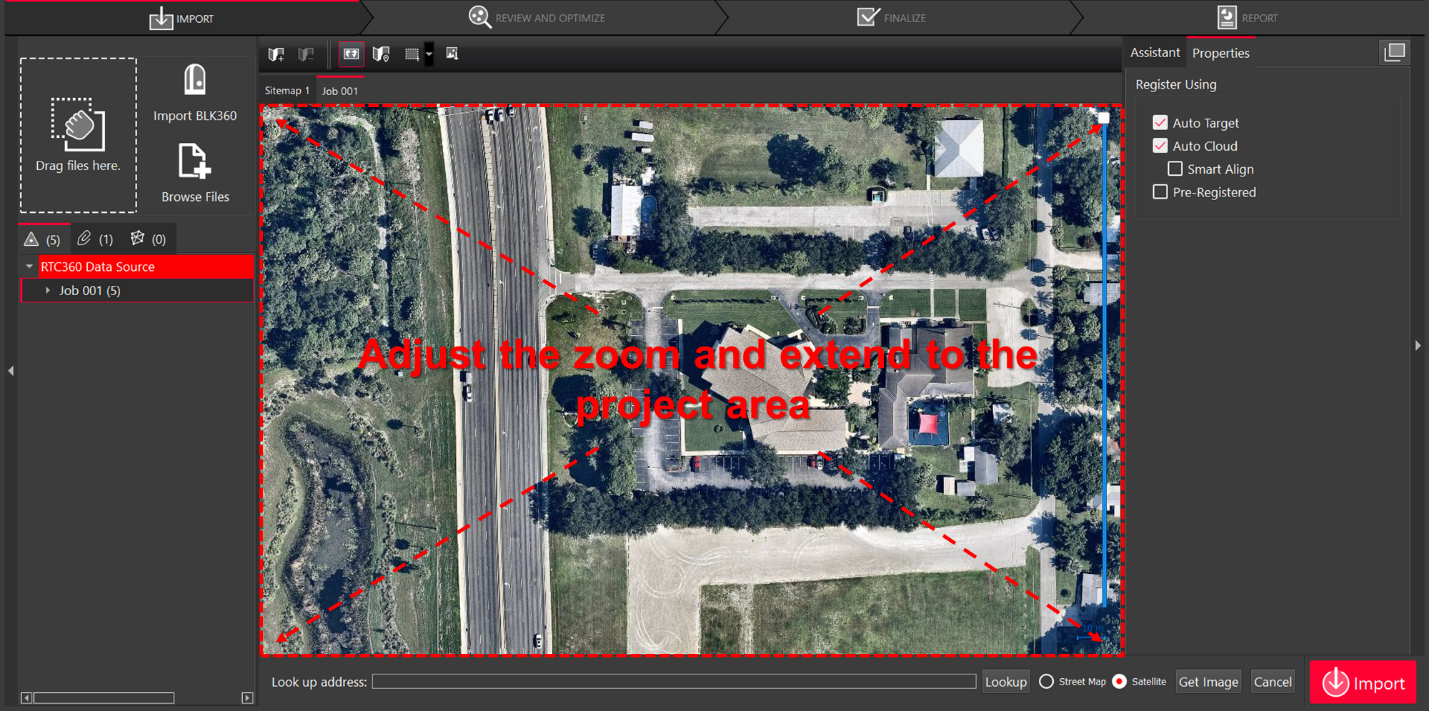
Select either the Street Map or Satellite background image options for use as a SiteMap.

Click Get Image.

Click Place by Geo Coordinates to display the Setups on the image.
.png?inst-v=b353e0c6-3946-47f8-87a8-dc31b372b903)
The geolocation and Setup position information from the RTC360 scanner makes it easier for the user to modify bundles, combine jobs, and perform Smart Align.