2022.1.1 | Third-party File Export
E57
Creates an E57 file. The E57 format is a compact, vendor-neutral file type for storing point clouds, images, and metadata produced by the laser scanners.
Scans and images, if available, will be exported.
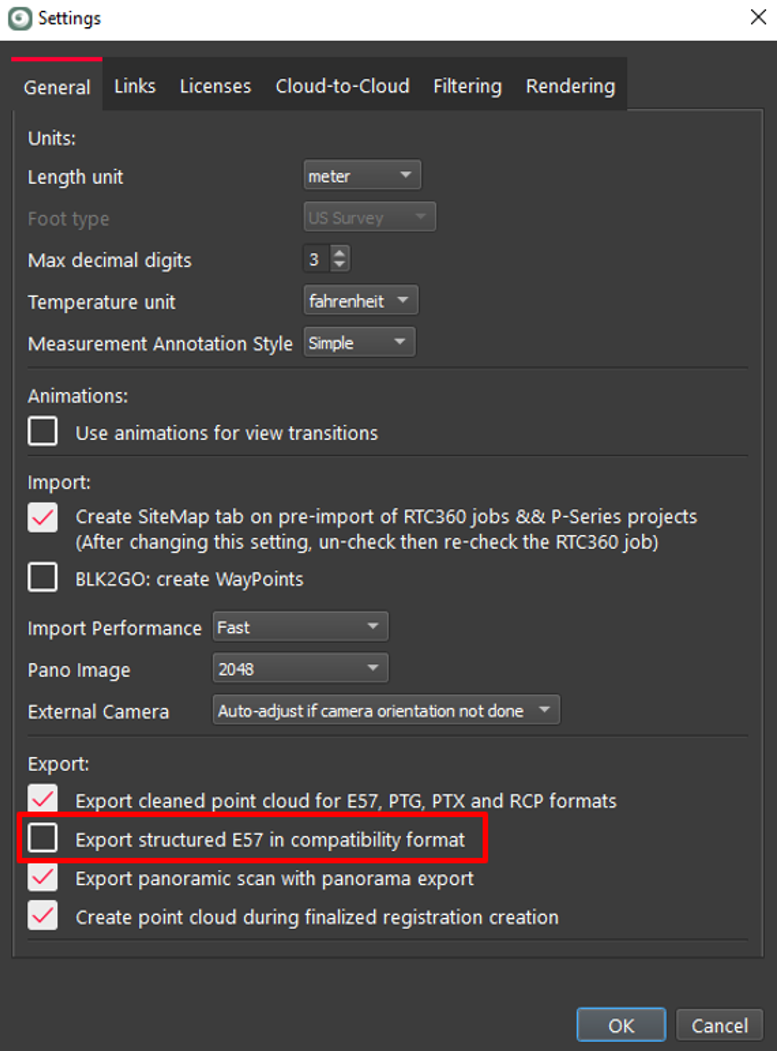
New E57 export option - Compatibility format
This new option normalizes the data written to E57 to make the E57 file more compatible with some third-party software (ReCap and Faro Scene as an example).
The option Export structured E57 in compatibility format is in the Settings menu under the General tab. The default setting is unchecked or off.
RCP
Creates an RCP file. The RCP format is an Autodesk format that supports ReCap, AutoCAD, and other Autodesk programs
Scans can be unified and exported as a single unstructured point cloud colorized with RGB if available or exported as separate scans registered with images.
RCP (Unified)
Exports a single unified cloud with color if available
RCP unified does not support images.
RCP unified must use a temp folder that can only be on a local drive. 30 GB of free disk space is required for every billion points exported at one time.
RCP (Setups)
Exports separate registered scans and images
Cyclone REGISTER 360 does not support the import of an RCP file exported from Cyclone REGISTER 360 as Cyclone REGISTER 360 does not support unstructured data.
Cyclone REGISTER 360 does support the import of structured RCP data.
Cyclone REGISTER 360 requires a PUBLISHER or PUBLISHER PRO license to publish to RCP.
Cyclone REGISTER 360 (BLK Edition) does not require a PUBLISHER, or PUBLISHER PRO license to publish to RCP.
PTS
Creates a single file containing the final published cloud. This consists of the total number of points in the point cloud followed by a stream of XYZ coordinates and the intensity value of the points.
This format supports point cloud cleaning. Any points removed with the cleaning tools will not be exported.
PTX
For each point cloud, Cyclone REGISTER 360 exports the XYZ coordinates and intensity value of each point with the associated registration transformation information. The point information is not transformed; the default coordinates system is used with meters and the units of measure.
PTG
Creates a single or multiple file(s) of the registration.
LAS
LAS is an unstructured data format. It does not support images or structured data.
Structured data exported to LAS will export as unstructured data with the unified Point Cloud version of the Finalized Registration.
SEMA
SEMA is an unstructured data format. It does not support images or structured data.
Structured data exported to LAS will export as unstructured data with the unified Point Cloud version of the Finalized Registration.
SEMA export requires a Cyclone PUBLISHER PRO license.