2022.1.1 | LGS Files
Leica Cyclone REGISTER 360 supports the publishing of LGS files, Leica Geosystems’ universal HDS digital reality file. LGS files contain all project information in a single-file solution for downstream consumption in all Leica Geosystems HDS software. The LGS file is perfect for storage and transfer between all Leica Geosystems’ HDS software products. The LGS file is a true single file, to simplify file sharing.
Publishing of LGS files requires a Cyclone PUBLISHER or Cyclone PUBLISHER Pro License .
LGS files can be consumed by Cyclone, TruView Enterprise and Cloud, JetStream Enterprise, TruView Desktop (formerly JetStream Viewer), CloudWorx plugins, Cyclone 3DR, IMS Map360 and some powered by JetStream products to allow for seamless data migration between the Leica Geosystems HDS software products. With the LGS file, users can access all their digital reality data, anywhere, with a single file.
Users may choose to publish an LGS file with or without a point cloud. When publishing specifically and only for consumption in TruView Enterprise or Cloud, it is recommended that the LGS file be published without the point cloud to reduce file size and prevent extended upload times.
Export Options
After selecting the file location for the LGS file, the Export Options button becomes active and is used to set LGS export options:
Set project name
This is the name that will show for the project in the supporting downstream programs.
Include Point cloud data
This option is used to include or not the point cloud data.
Allow TruView Measurements
Fast upload to TVC and TVE
Smaller LGS project file size
Faster publishing in general
The default to set to export TruView measurements. Exporting without TruView measurement support has the following benefits if measuring in TruView is not required:
The option is in the export dialogs for TruView Cloud, TruView Enterprise and LGS:
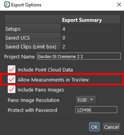
Include Pano Images
This option is used to include or not the panoramic images.
Pano images resolution (1K-5K)
5K panoramic images are not support for TruView Local (Active X)
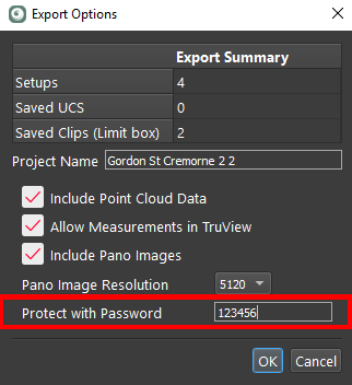
Protect with Password
Once set, the password is irretrievable. If the password is lost there is no way to open the file or find out what the password was. A new file will have to be published with a known password.
LGS File Structure
LGS files may contain the following information based on the hardware used for data capture and the user’s publishing settings.
Project Metadata
Name
Thumbnail
Coordinate system
Publish date
Creator/Company info
Number of SiteMaps
Number of points
Number of setups
Imagery metadata and #s
Project SiteMaps + Metadata
SiteMap image(s)
Hyperlinks (between SiteMaps)
Setups
Project Setups + Metadata
Name
Timestamp
Targets + metadata
RGB pano imagery
HDR pano imagery
Intensity Hue pano imagery
Intensity Grayscale pano imagery
Modeled Geometry pano imagery
IR pano imagery
IR temperature scale
Point Cloud + Metadata
RGB colors
HDR colors
Intensity Hue colors
Intensity Grayscale colors
UCS
Clips
Limit Boxes
GeoTags + Metadata
3D position
Type
Category
Label
URL
Timestamp
Associated assets (e.g., images, PDFs, videos, audio, etc.)
Control + Metadata
Control files
Assets + Metadata
Files
Images
Views
Slices